The government has taken initiative to excavate four rivers to restore water flow, improve inland shipping and flood management at the cost of Tk 4,168.16 crore.
To this end, a project to excavate four rivers including Jinai, Ghaghat, Banshi and Nagda has been proposed to the Planning Commission, a planning commission official said on Monday.
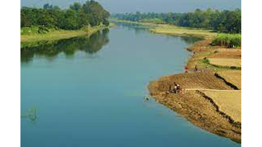
Experts said that the navigability of the river will be improved and restored through excavation at the confluences of these four rivers.
The waterways will be navigable to ensure smooth and uninterrupted navigation throughout the year, they said, adding that river banks will be protected at landing stations and problems solved.
They said due to the rising water flow, farmers can easily irrigate their land, and natural habitats for plants and animals.
Dredging also reduces the risk of flooding and drainage congestion, while enhancing nutrient retention and carbon sequestration.
Another Planning Commission official said that the PEC (Project Evaluation Committee) meeting was held on June 29 last year after receiving a proposal from the Ministry of Shipping.
The project has been recommended to be presented at the meeting of the Executive Committee of the National Economic Council (ECNEC) as it complied with the recommendations given at the meeting, he mentioned.
Read more: River Boral turns to narrow spectre of water flow
Once approved, Bangladesh Inland Water Transport Authority (BIWTA) will implement it by June 2026, he added.
The project proposal states that the Ghaghat River from Nilphamari to Gaibandha, the Banshi River flowing from Jamalpur to Keraniganj in Dhaka, the Jinai River from Sherpur to Tangail and the Nagda River in Gazipur District have been silted for a long time without any excavation.
Although there is navigability in the rainy season, in the dry season the flow of water decreases and navigation is disrupted.
To this end, surveys are conducted through the Institute of Water Modeling (IWM) to improve their navigability.
The main activities of the project are: 2,164.50 km hydrographic survey, 505.5 lakh sq m engineering survey, 2,000 hectare crop compensation, construction of 140 lakh cubic meters soil dyke, Excavation of 329.50 million cubic meters by BIWTA dredger, 6.37 km river bank conservation dam and 460 mass consultancy services.
Ghaghat river: The river starts from Teesta river in Kaimari union of Jaldhaka upazila of Nilphamari district and falls into Jamuna river in Kanchipara union of Fulchhari upazila of Gaibandha district.
The river is much wider downstream than downstream. The length of the river is 192 km, width is minimum 20 m, maximum 50 m, average 40 m.
Although there is a lot of water flow in the river during monsoon season, there is no flow till February-April.
At present the Ghaghat river does not belong to any waterway category. Excavation will result in part of this river being elevated to the Class IV Navigational Route.
Banshi river: Hamidpur of Jamalpur Sadar originates from old Brahmaputra river and falls into Dhaleshwari river at West Hazratpur of Keraniganj upazila of Dhaka district.
Again a branch came out of Bamuji beel of Sultan Nagar of Jamalpur Sadar and took the name of Banshi and came to a place called Rashidpur of Jamalpur Sadar and fell into the main Banshi river.
The length of the river is 260 km, width is minimum 5 meters, maximum 200 meters. The river will require 63 km of excavation from Fortnagar in Savar to Nayahat-Dhamrai-Shailan-Kalampur-Kushura-Balia-Rajapur.
Jinai River: The Jinai River originates from the old Brahmaputra River in Kamarchar Union No 1 of Sherpur District and flows into Nagbari Union of Kalihati Upazila of Tangail District under the names Fatikjani and Chapai.
The Jharkata River merges with the Kamarabad Union in Sarishabari Upazila of Jamalpur District and re-emerges along the Jinai River.
The length of the Jinai River in Bangladesh is 142 km, minimum 20 m wide and maximum 60 m wide.
Nagda river: It originated from Shitalakshya river near Char Sindur union of Palash upazila of Gazipur district and fell into Balu river in Baria union of Sadar upazila of the same district.
The length of the river is 22 km, width is minimum 5 m, maximum 25 m. The lower part of the bridge constructed at the junction with Shitalakshya has been filled, disconnecting the river from Shitalakshya.
Due to the disconnection, the flow of water has decreased compared to that in the past.