The Bangladesh Digital Survey (BDS) has been launched in the country officially aiming at completing the cadastral survey in Bangladesh in a short time and reduce the need for field surveys
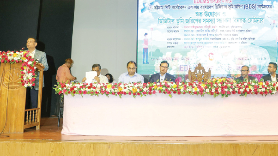
Land Minister Saifuzzaman Chowdhury officially inaugurated the rollout of Bangladesh Digital Survey (BDS) at a function at the auditorium of Primary Teachers Training Institute (PTI) in Chattogram city on Sunday (August 6, 2023).
Speaking at the event, the minister said that the journey of Bangladesh Digital Survey (BDS) program promised by Prime Minister Sheikh Hasina has started across the country with the BDS rollout in Chattogram.
Mentioning that the first science-based survey started in Bangladesh about 130 years ago from Chattogram, he expressed hope that the BDS, which now began in Chattogram, would be the final survey conducted in the field.
He also said that there will be no need for a revisional survey for the convenience of digital map partition if there is no major land deviation due to natural reasons in any area.
Saifuzzaman Chowdhury at the event also spoke about the proposed ‘Land Crime Prevention and Redress Act’. He said that the draft law will be placed in the Parliament in September. Provisions for both imprisonment and fines as penalties for engaging in illegal land occupation were included in the proposed law, he informed.
Secretary of the Land Ministry Md. Khalilur Rahman presided over the event where Divisional Commissioner of Chattogram Md. Tofayel Islam was present as a special guest.
Director General of Land Records and Survey Department Md. Abdul Barik, EDLMS project director of BDS programme Zahurul Islam, Deputy Commissioner (DC) of Chattogram Abul Bashar Mohammed Fakhruzzaman, Chattogram Zonal Settlement Officer Afia Akhter were also present on the occasion, among others.
In his presidential speech, Md. Khalilur Rahman said that Mouza map and khatian will be available online at the same time in BDS program. Within 15 days, a Khatian will be prepared with map of automatically created holding
Earlier, on August 3 last year (2022), the Land Minister inaugurated the BDS piloting program in Patuakhali. Based on the success of the pilot, the Land Minister inaugurated the full-fledged BDS program from Chattogram.
First Phase of BDS program:
The first phase of BDS rollout activities will be conducted in the areas of Chattogram, Narayanganj and Rajshahi city corporations, Dhamrai and Kushtia Sadar Upazilas (including municipalities) and Manikganj municipality totalling 634 mauzas covering 933 sq km (2lakh 38 thousand acres) area under the ‘Establishment of Digital Land Management System (EDLMS)’ project.
The latest technology including Satellites, Drones/UAVs, and Ground Control Stations will be used in Bangladesh Digital Survey to accurately survey the land digitally. Once BDS is implemented, automation systems will be introduced, including land survey, network establishment within land management offices.
With the establishment of linkage between mouza-map and record, land owners will be able to easily view records and plots online. Transparency and accountability in land survey and management will be ensured, which will reduce public suffering and create skilled human resources.
The entire system of BDS will be integrated as a module of the National Land Service Automation System. The geo-referenced Mauza map determined under this project will be provided to the ‘Land Management Automation’ project. After the sale of the land, the map boundaries will change along with the change in the Mutated Record of Rights.
BDS to be implemented under two projects:
BDS program will be carried out simultaneously throughout Bangladesh in phases under two separate projects. The projects will be conducted under the direct supervision of the Land Ministry under the management of the Land Record and Survey Department.
One of the two projects is the ‘Establishment of Digital Land Management System (EDLMS)’ project. A total of Tk. 383.50 crore has been allocated for this through financing from the government and the Korea Economic Development Cooperation Fund (EDCF). Out of which Tk.78.10 crore has been allocated from the government and Tk. 305.40 crore from Korea.
The other project is ‘Strengthening Operational Capacity of the Department of Land Records and Surveys (DLR&S) for Digital Survey Project’ (SOC-DDS). Tk. 1212.55 crore have been allocated in government funding for this. Under this project, the BDS rollout will start across the entire Barguna and Patuakhali districts.
Short history of cadastral survey programs:
Incidentally, the first science-based modern cadastral survey program, i.e. the land survey program in Bangladesh, was experimentally started in 1888 in Ramu of Cox’s Bazar sub-division of the-then Chattogram district.
This survey program was known as the cadastral survey (CS survey) by its basic generic name. In light of the experience in Ramu, CS survey program were carried out across the entire East Bengal beginning from Chattogram in 1890 and ended in Dinajpur district in 1940.
As some areas of Chattogram and Sylhet were not administratively part of Bengal at that time, a CS survey was not conducted in these areas.