An earthquake is a movement of the earth's surface that causes it to tremble or shake. The majority of earthquakes are mild tremors, whereas larger earthquakes often begin with minor tremors, swiftly transform into one or more powerful shocks, and conclude with gradually diminishing force vibrations known as aftershocks. An earthquake is a type of wave energy that originates in a small area and then expands out in all directions from the point of origin.
Typically, it lasts from a few seconds and a minute. The focus is the spot within the earth from where earthquake waves start and from which the vibrations radiate in all directions. They first reach the surface at the location immediately above the focus, which is referred to as the epicenter. It is at the epicenter that the initial jolt of the earthquake is felt.
An earthquake can be classified as shallow focus (0-70 km), intermediate focus (70-300 km), or deep focus (> 300 km) based on its depth of focus. The Richter magnitude is the most often used unit of earthquake size measurement (M). The Richter scale determines magnitude by examining the greatest surface wave amplitude in the seismogram and the difference in the arrival periods of primary (P) and secondary (S) waves (M). The magnitude is approximately proportional to the logarithm of the energy, E in ergs.
Read More: Dhaka highly vulnerable to earthquake
Earthquakes occur for a variety of reasons, which are classified into two broad categories: non-tectonic and tectonic. The 'elastic rebound theory is used to explain the origin of tectonic earthquakes. Earthquakes occur in an uneven distribution over the globe. However, it has been found that the majority of catastrophic earthquakes originate within two well-defined zones or belts: the 'circum-Pacific seismic belt' and the 'Mediterranean-Himalayan seismic belt'.
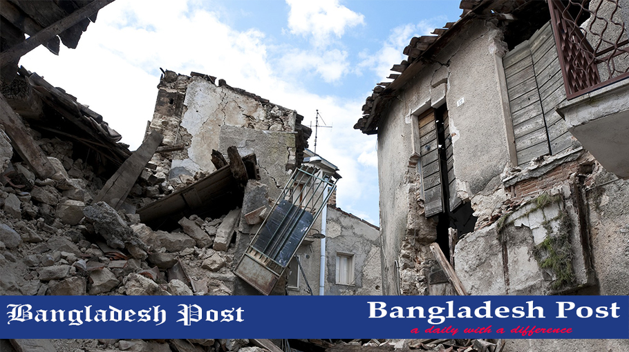
While Bangladesh is particularly susceptible to seismic activity, the nature and magnitude of this activity are unknown. Bangladesh lacks comprehensive earthquake monitoring facilities. In 1954, the Bangladesh Meteorological Department erected a seismic observatory in Chittagong. This is the country's sole observatory.
Accurate historical data on earthquakes is critical for evaluating Bangladesh's seismicity concerning geotectonic factors. For the last 250 years, data about earthquakes in and near Bangladesh are accessible. According to the earthquake record, more than 100 moderate to major earthquakes has occurred in Bangladesh since 1900, with more than 65 of those occurring after 1960. This reveals an increase in the frequency of earthquakes during the last three decades. This rise in seismic activity is indicative of renewed tectonic activity or fracture propagation from surrounding seismic zones.
There was no definitive record of earthquakes before the arrival of the Europeans. The following is a timeline of significant earthquakes since 1950:
1950:
Also referred to as the Assam Earthquake. On 15 August, an earthquake of a magnitude of 8.4 struck Assam, India. The tremor was felt across Bangladesh, although there were no reports of damage.
1997:
On 22 November, a magnitude 6.0 earthquake struck Chittagong. It caused minimal damage in the vicinity of Chittagong.
1999:
On 22 July, Maheshkhali Island was struck by a magnitude 5.2 earthquake with the epicenter in the same location. Severely felt in the vicinity of Maheshkhali island and the adjacent sea. Houses developed cracks and, in some instances, collapsed.
2003:
On 27 July, a magnitude 5.1 earthquake struck Kolabunia union in Barkal Upazila, Rangamati district. At 05:17:26.8 hours, the time was 05:17:26.8 hours.
2006:
The earthquake is referred to as the Narail earthquake. On 5 August, this tremor happened. The magnitude of the earthquake was assessed to be 4.2 on the Richter scale, with the epicenter 110 kilometers southwest of Dhaka near Narail. The tremor was felt throughout Dhaka and other parts of the country.
2008 (1):
This earthquake is referred to as the Manikganj earthquake. On the evening of 20 March 2008, a mild earthquake rocked Dhaka and its environs, causing widespread alarm among city people. The magnitude of the earthquake was 3.8 on the Richter scale. The epicenter was located 41 kilometers west-northwest of DUEO in Manikganj. It was originally thought to have started near the Madhupur fault.
2008 (2):
This temblor, dubbed the Mymensingh earthquake, struck in the middle of the night on 27 July 2008. The epicenter of the earthquake was located 12 kilometers northeast of Mymensingh and 120 kilometers north of Dhaka. It was assessed to have a magnitude of 5.1 on the Richter scale. Apart from Mymensingh, where the earthquake created fear, tremors were felt throughout the Dhaka metropolitan area.
2008 (3):
Also referred to as the Chandpur Earthquake. On the evening of 20 September 2008, just before Iftar, Dhaka was shaken by an earthquake and a few aftershocks. It sparked widespread alarm among city people. The epicenter was located 50 kilometers southeast of Dhaka in the Chandpur district of Kachua. On the Richter scale, the magnitude was 4.5.
2009 (1):
Also referred to as the eastern Bhutan earthquake. On the eve of Eid-ul-Fitr, 21 September 2009, a powerful earthquake struck. The epicenter was located in eastern Bhutan, some 410 kilometers north of Dhaka. It developed as a result of the Main Central Thrust (MCT). Although the magnitude of this distant quake was 6.1, it shook the majority of Bangladesh, including Dhaka.
2009 (2):
Also referred to as the Bay of Bengal Earthquake. This occurred on 11 August at 01:55:35: 61 hours in Bangladesh. The epicenter was centered in the Bay of Bengal's North Andaman Islands and along Myanmar's seacoast. Magnitude 7.5 was registered. Though there were no reports of serious damage throughout Bangladesh, the tremor was felt powerfully in Dhaka.
2010:
It occurred at 11:30 p.m. local time on 10 September. The magnitude 4.8 tremor was felt in Dhaka and the neighboring areas. The epicenter was about 45 kilometers southwest of Dhaka.
2011:
At 6:30 p.m. local time, a magnitude 6.8 earthquake occurred. It lasted approximately two minutes. The tremor was felt strongly in the capital city of Dhaka and the districts of northern Bangladesh. The epicenter was located 500 kilometers north of Dhaka in Gangtok, the capital of Indian Sikkim.
Read More: Earthquake jolts parts of Bangladesh
If you liked this article, then please subscribe to Bangladesh Post YouTube channel for latest news. You can also find us on Twitter and Facebook.